Last week I was up in the North East with work. An intersting project for my second, part time academic job! I used this as an opportunity to visit some of my relatives up there and they were kind enough to put me up (and put up with me 😉) for a couple of days. I drove up on the Monday planning to arrive before sunset. As it happend I got there quicker than expected so decided to stretch my legs and get some fresh air after a long drive.
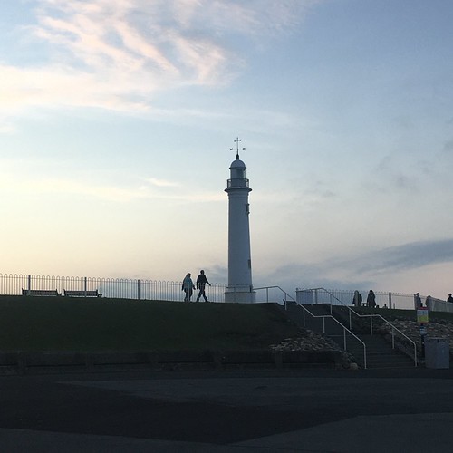
I parked up near Souter lighthouse and strolled along the cliffs. During the walk the sun began to set and I was treated to a glorious sky lit up red and gold, reflected in the sea. My photos, snapped on my phone, don’t really do justice to what I saw.
The weather changed on the last day of our holiday. The rain came in and the temperature dropped. So it was a day for stopping in, reading, relaxing, drinking tea and eating cake (!) and otherwise occupying ourselves. But I do get itchy feet so during the afternoon, when the rain had eased for a while, I went out for a short walk on the West Cliff and took a few shots to remind me of an enjoyable week in the historic seaside town.
The Crescent – only half of it was ever built!
The statue of Captain Cook looking out to sea
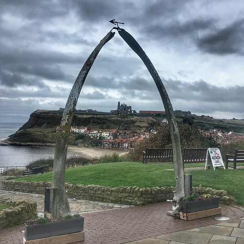
Looking through the Whalebone Arch – it’s hard to get a chance of this shot on a fine day as everyone wants their photo taken under the arch – not as much of a problem on a colder, wet day!
A neo Gothic house – a little creepy given which novel is set here
The Modernist style pavillion by the outdoor paddling pool
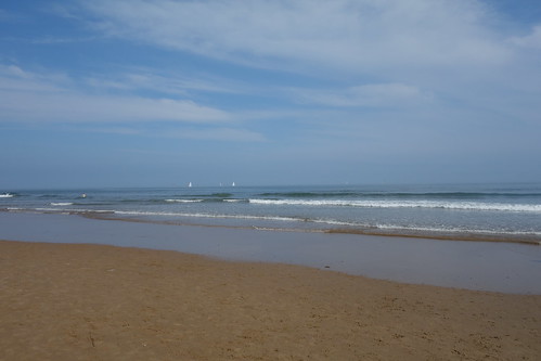
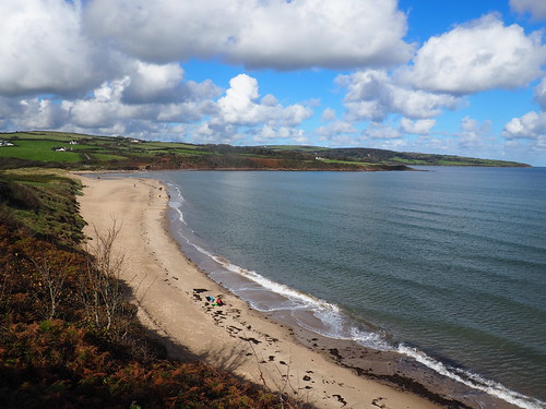
I decided to walk down to the bottom of the cliff and take a short stroll on the beach
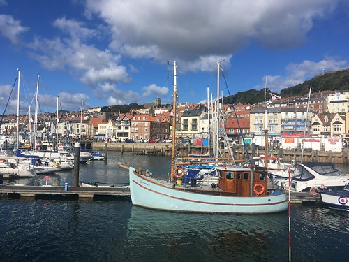
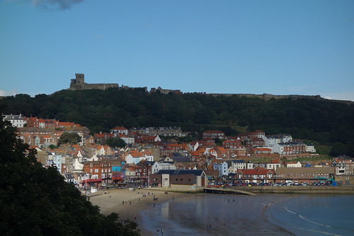
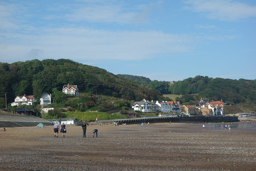
The Thursday of our holiday we drove over to Scarborough. As far as I can remember I’d never been there before (although I’d been to Filey and Bridlington, a little further down the course, in the distant past). But Scarborough is the largest resort on the North Yorkshire coast. It’s been a popular destination since the 17th Century, originally as a Spa resort, but it really took off after the opening of the Scarborough–York railway in 1845, which brought in workers from the Yorkshire mill towns. The town goes back much further, though, as demonstrated by the impressive remains of a medieval castle on the hill overlooking the town. The Romans were certainly here and it’s likely that the town was founded by the Vikings. It’s built around two bays, separated by the hill that’s topped by the castle. The Marine Drive now goes round the end of the cliffs, linking the 2 bays, but this hasn’t always been the case.
There’s plenty of parking – not free, mind – and we parked up on the Marine Drive on the north bay. We walked round to the south bay, the site of the original medieval old town, and the attractive harbour.
The Belle
After exploring the harbour we walked along hte prom on the south bay which is typical of a British seaside resort with the usual tacky amusment arcades and shops selling trinkets, with the odours of fish and chips, greasy fry ups and do-nuts constantly present. We carried on, climbing up through the gardens before the Grand Hotel, to the top road where there was a good view over the bay to the castle.
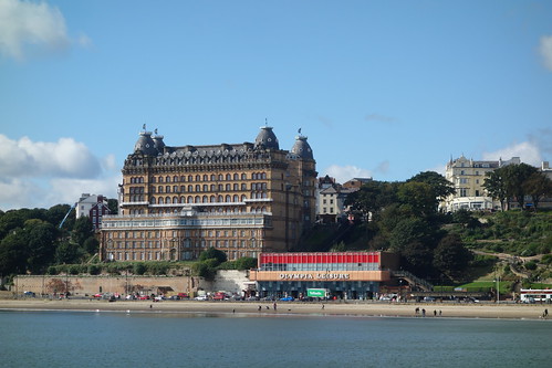
The Grand Hotel was opened in 1867, when it was the largest hotel and the largest brick structure in Europe. It’s a Grade II* listed building. Today it’s owned by Britannia Hotels and so, like all their other hotels, it’s best avoided.
We’d decided to visit the small museum so made our way past the Grand Hotel
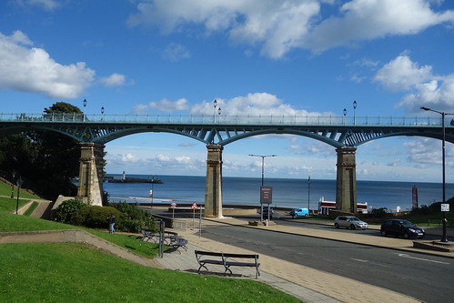
Pedestrian high level walkway
walking the short distance to the Georgian Rotunda building where it’s located.
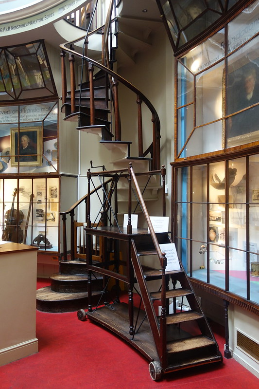
The mseum has small, but interesting, collection – mainly concentrating on fassils and the geology of the area.
rather a lot of ammonites!
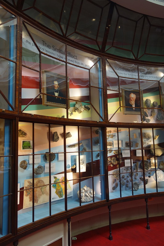
The exhibits in the drum of the building are displayed in a way that probably hasn’t changed much since it was founded.
Some of the exhibits displayed in glass cabinets lining the walls of the drum
The old spiral staicase leading to the, now inaccessible, upper level in the dome.
Some more exhibits
The dome is very impressive – but it’s impossible to capture that in a photograph.
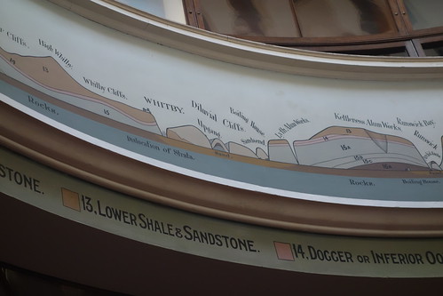
A frieze around the base of the dome shows the geology of the north Yorkshire coast. I zoomed in on the section showing the Whitby area
We spent about an hour in the museum and then headed across the town towards the castle – and that deserves a post of it’s own. We also wanted to visit a celebrity in the old churchyard – you’ll have to wait to see whao that is (or perhaps you can make a guess!).
There was more to see in Scarborough, but our time there was limited. I’d have liked to have walked round to the old Spa building and the funicular railway and also spent some time walking along the norrth bay. It’s certainly worth another visit if we’re over that way again.
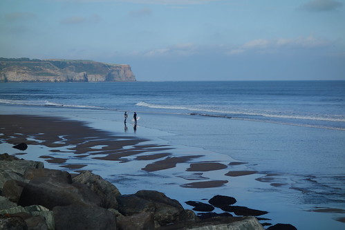
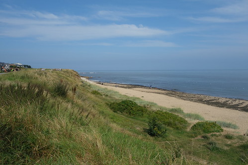
There’s a long stretch of sandy beach to the north of Whitby. At the other end, nestling underneath the cliffs, is the small village appropriatly named Sandsend. It was originally a fishing village, then a home for workers in the alum extraction industry. Today it’s a tourist resort and, apparently, the most expensive place to buy a property on this stretch of the coast!
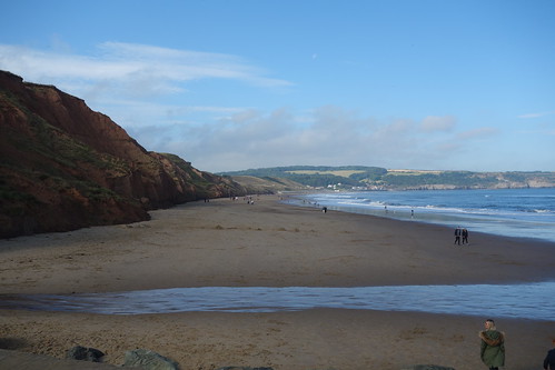
On the Sunday morning of our holiday in Whitby, as the tide was going out, I set out with my son to walk the 3 miles to the village. It was a fine morning and although there was a bank of cloud hovering over Whitby, we were in the sunshine as we headed north.
Looking down to the beach where the tide was receding, from the cliffs near Whitby Pavilion
Although it was early, there were quite a few people taking some exercise on the beach and / or walking their dogs!
Passing the colourful beach huts
There were a few surfers out
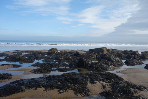
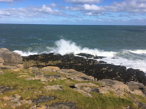
A rocky stretch
Approaching Sandsend. We didn’t stop to look around the village as we’d planned to visit the Abbey that afternoon and time was getting on.
Halfway back to Whitby, we took a path that climbed halfway up the cliff to get a different perspective
We were walking towards the cloud now, but it was clearing and we were in the sunshine most of the way back to Whitby
Looking down on the beach huts and towards the harbour
We took the path up to the top of the cliffs a short distance before the Pavillion and passed one of the heritage statues celebrating thealleged invention of the “Crow’s Nest” by local man, William Scoresby
And a second one, of Skipper Dora Walker (1890-1980), the first female fishing boat skipper on the North East coast.
A little further on we turned off the cliff top path back down towards Skinner Street and our holiday cottage.
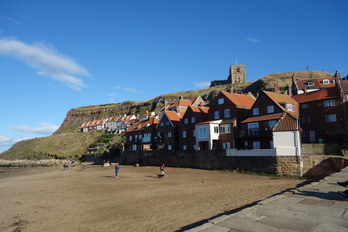
We’re just back from an enjoyable family holiday in the historic seaside town of Whitby. This was our second visit having had a holiday there in July 2017.
The town developed following the establishment of an Anglo Saxon monastery high up on the East Cliff in 656 by Oswy, the Christian king of Northumbria. It’s in a narrow valley at the mouth of the River Esk, flanked by tall cliffs. The original settlement was at the bottom of the cliffs on the east side of the river, eventually spreading over to the west bank. It’s location means that it’s a maze of steep, narrow streets and ginnels – not the easiest of places to drive around!
Until relatively recently it was very much an industrial town with alum quarries on nearby cliffs and shipbuilding was a major industry – it’s hard to believe that in the 18th century it was the third largest shipbuilding port in England. Not surprisingly it was a fishing port and in the mid 18th century it also became a centre for whaling. Whitby developed as a spa town in Georgian times and tourism really took off in the mid 19th Century with the arrival of the railway, leading to the development on top of the West Cliff.
Bram Stoker stayed in Whitby and it inspired him to write his novel, Dracula, which started with the Dementer, the ship carrying Dracula running aground, its crew missing, its dead skipper lashed to the wheel was wrecked on Tate Hill Sands, below the East Cliff (his inspiration for this was the beaching of a Russian ship, the Dmitry, on the sands in 1885). One of the novel’s characters, and Dracula’s victim, Lucy Westenra, was attacked by the Count in St Mary’s Churchyard, the Parish Church that stands in the shadow of the Abbey.
We had a relatively easy week, spending our time wandering around the streets, cliffs and beaches with only one trip out to Scarborough. We didn’t spot any vampires, fortunately!
Here’s a few snaps that I took around the town during our stay, starting with a few views of the East Cliff from the harbour and West Cliff
This is the beach where the Dmitry ran aground – the inspiration for the start of Bram Stoker’s novel.
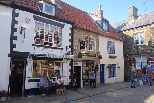
Some of the shops in the “main street” of the East Cliff
Looking up the 199 Steps that lead up to the Parish Church and the ruins of the Abbey. In bram stoker’s novel, Dracula, in the guise of a black hound, ran up these steps up to the top of the East Cliff after the shipwreck.
Looking down to the harbour from part way up the 199 steps
Looking over the graveyard to the Abbey
The Abbey ruins
This modern bridge linking the east pier and the east pier extension of the harbour walls. An addition since our last visit.
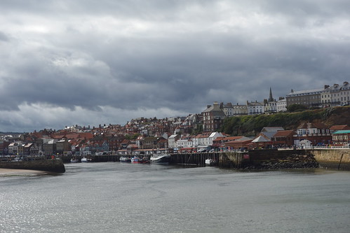
Looking down over the harbour to the West Cliff from the top of the East Cliff
Another view over to the West Cliff settlement
The monument to James Cook, who, as an apprentice seafarer, was based in the town
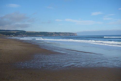
There’s a fine beach to the west of the town stretching a couple of miles to the small hamlet of Sandsend
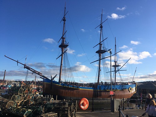
A replica of Cook’s Endeavour
Another change since out holiday in 2017 – there were a number of these wire statues of former residents of the town illustrating it’s heritage.
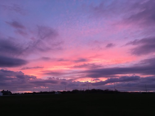
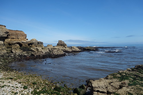
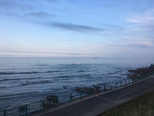
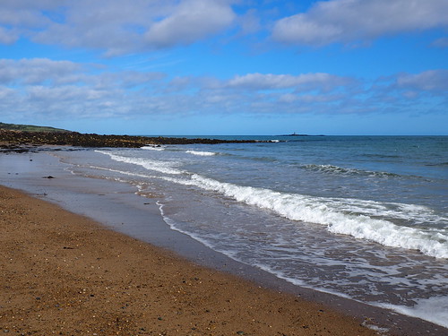
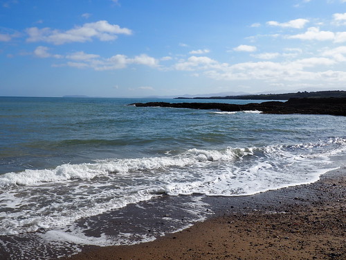
Last Monday, before setting off on the long drive home, we took a couple of hours to go for a walk on the cliffs north of Whitburn near Souter lighthouse.
The lighthouse opened in 1871 and was the first in the world with an electrical powered lamp. It was decommissioned in 1988 – but not before the foghorn kept me awake during my first visit to Whitburn, when it operated throughout a foggy night, while we were staying at J’s auntie’s house (the house where she was born!).
Battered by the sea and the elements, the cliffs are eroding, a process being accelerated by climate change. Since we were last here, sections of the coastal path have been diverted due to safety concerns
The cliffs are home to sea birds, including Kittiwakes, Fulmar, Cormorants, Shags and Guillemots.
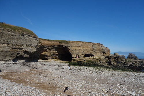
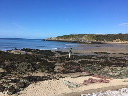
To the south of the lighthouse, the coastal path descends and there is access to a small cove known as the Wherry, a popular local recreation spot in the past when fishing boats were kept in and launched from the cove.
There’s a lot of history in the area. Although today the coast between Whitburn and South Shields are owned by the National Trust the top of the cliffs is a pleasant lawned area not that long ago they were dominated by industry with a coalmine (Whitburn colliery) lime kilns and a railway running along the top of the cliffs. There’s no sign today of the mine, (where my wife’s grandfather used to work) but the old lime kiln just over the coast road still remains as a reminder of the industrial past.
The Marsden Banner Group have some good information on the history of the colliery and the village on their website.
Last weekend we were up in Sunderland for a family wedding. We hadn’t been up to the North East for about 4 years, visits delayed due to lockdowns and travel bans, so it was good to have an opportunity to catch up properly with family, rather than relying on posts on Facebook and Instagram.
We drove up on Friday, the day before, and stayed in the new Seaburn Inn hotel on the sea front. Although it’s very much an industrial town, Sunderland has a fantastic beach and coastline stretching from Roker through Seaburn and then on to Whitburn. We had paid a little extra for a room on the front with a balcony, hoping to enjoy the views over to the sea. The weather was rather dull when we arrived and it rained on Saturday (but, I’m glad to say, this did’t spoil the wedding), but it brightened up for the next couple of days. I’m always up early and was out for a walk along the Prom each morning irrespective of the weather.
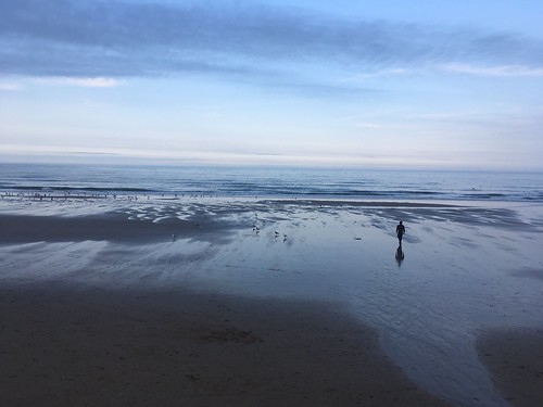
A dull morning, but it’s still enjoyable to walk along the Prom
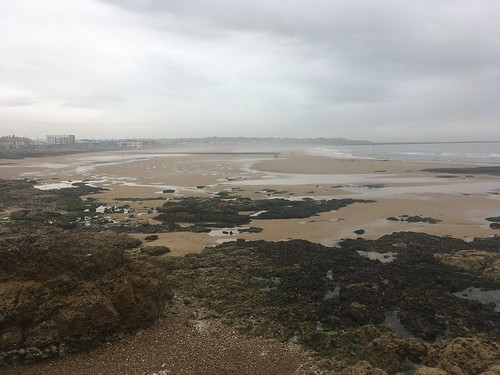
And on Sunday afternoon, after a family gathering in the morning, we were able to enjoy a walk along the beach in the sunshine, from our hotel as far as the start of the cliffs at the boundary with Whitburn.
We then spent a little time on the balcony reading and enjoying the view before an earlyish tea in the hotel bar. After that we enjoyed an evening walk along the shore towards Roker and back, finishing off with a drink on the balcony.
After our walk around Parys Mountain we decided we’d drive a little further along the north coast of the island to the small resort of Cemaes – the most northerly village in Wales. Originally a fishing village, particularly for herring, and a port for the export of bricks, today it very much relies on tourism with it’s sandy beaches and pretty little harbour.
We drove into the village, missing the turn for the car park down by the beach but managed to find a large car park up the behind the main shopping street. I was amazed to find that parking there was free. Makes a change!
It’s quite a small place and it didn’t take long to look round. We walked along the main street, which had a only a few shops (some of them shut down, sadly), and then down towards the picturesque harbour. the tide was out so the fishing and pleasure boats were all stranded in the mud.
There was still some evidence of fishing and we saw a couple of men loading up crates of lobsters into their van. None for sale locally, though.
Then on to the beach
There were signs up making it clear that dogs were only allowed on a resticted section of the beach during the main season (which hadn’t finished). But what did we see. Yes, several dog walkers ignoring the instruction. It illustrates the problem that if you implement meaures people are required to follow the message must be clear (it was in this case), reinforced and enforced. Just the same with masks and social distancing at the moment. (Rant over!) Having said that, there were very few people on the beach and the promenade. It was very quiet and peaceful.
We were intrigued by this structure standing on the beach
A little research revealled it to be “St Patricks bell“. It’s one of several bells located at coastal locations around the UK by the Time and Tide project to celebrate the connection of local communities between themselves, the land, the sea and the environment. In Cemaes the bell celebrates the local legend that St Patrick was shipwrecked on the nearby island,Ynys Badrig, where he founded a church in 440 AD, introducing Christianity to Britain.
The bell is rung by the high tide, and is meant as a reminder of rising sea levels caused by global warming. Gillian Clark, a favourite poet of mine, composed a poem for the dedication of the bell and read it at the installation ceremony
Mewn gwynt a glaw, gwyll neu oleuni, heulwen, lloergan, pan fo’r tonnau’n taro ar y traeth dan dynfa’r lleuad, bob dydd, adeg y penllanw, swn y tonnau, sain y gloch yn canu.
And in English:
At the turn of the earth, heartbeat of the deep under the wind’s breath, as the sea stirs in sleep under the moon’s gravitational pull, when the tide’s at the full, at the twelfth hour the bell will toll.
Cast in bronze, the colour of the metal changes due to the action of the environment – air, water and salt.
I notice that one of the bells was installed last year on the Stone Jetty in Morecambe. I’ll have to go and have a look some time.
We didn’t stay very long but after strolling along the beach set back off to our accommodation, stopping at the sizeable Co-op in Amlych to pick up a few supplies. We then finished off the afternoon by walking down to Lligwy beach. Unfortunately the little cafe was closed 😦
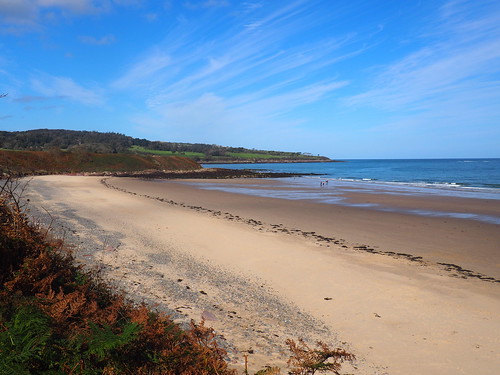
The second day of our holiday the wind had dropped and we were greeted by a fine sunny morning. So the boots were back on and we were off down the path through the fields for another walk on the coastal path, this time heading north towards Traeth Dulas.
The tide was out again when we reached Traeth Lligwy
Off we set. the temperature was just right – neither too hot nor too cold and we were walking in t-shirts for most of the afternoon.
The geology was quite different than when we walked south to Moelfre. That way was dominated by Carboniferous limestone whereas heading north the rocks were predominantly sandstone and shale, deposited in a semi-arid, sub-tropical environment millions of years ago.
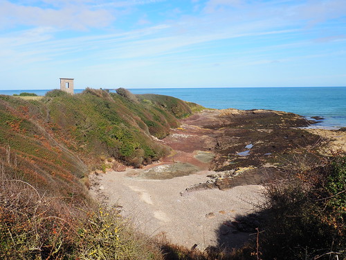
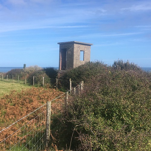
We soon reached a concrete lookout post up on the cliff looking over the sea. I reckon this was a remnant from WW2 as it would overlook the shipping route into Liverpool.
The path descended down to a sand and shingle cove before climbing back up on the low cliffs.
As the wind had dropped, the sea was calmer than the day before. We had a brief walk on the sand, inspecting the variety of pebbles that were washed up on thebeach.
Looking south from the beach with the Great Orme and the northern Snowdonia mountains visible on the horizon
Back up on the cliffs
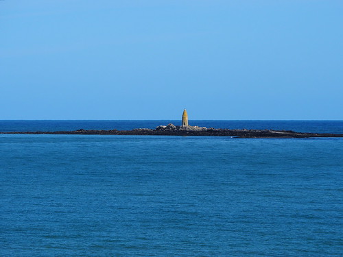
I’d brought my long range lens with me so zoomed in on the tower on Ynys Dulas.
Carrying on the path, down below was Traeth yr Ora. This fantastic beach is only accesible via the coastal path or from the sea – there’s no road or car parks nearby. It was almost deserted except for a small number of people.
Looking down to the beach from the north.
We diverted of the coastal path which swung inland and around the Dulas bay / estuary. We carried on a permissive path along a headland which overlooked the beach and the bay. We spotted a couple of fishermen – I don’t think it was Whitehead and Mortimer though.
The tide was still well out and the Dulas Bay was almost dry. We could see the wreck of a large boat resting on the sand. I wonder whether it was wrecked or just deserted?
The path looped back from the headland and we retraced our steps along the coastal path back toward Lligwy.
We stopped for a while to take a break at this rather attractive carved bench which overlooked the sea.
Interesting rock formations.
We arrived back at Traeth Lligwy. We fancied a brew but the cafe was busy – there was a lengthy queue and all the seating was taken so we decided on a walk along the beach, returning after half an hour or so when the cafe was a lot quieter.
Another good coastal walk on a perfect day for walking.
Well, I don’t really need to say that it’s been a funny old year but, of course, it has been. As a consequence, our original plan for a transatlantic trip for our main summer holiday had to be abandoned (luckily we hadn’t quite got round to booking anything). After restrictions were lifted, we decided to try to book a self catering cottage somewhere but were a little slow off the mark and we couldn’t find anything suitable during the main holiday period. I’d taken a couple of short walking breaks in the Lakes on my own, but we hadn’t been away together. J fancied a holiday near the sea, and that sounded like a good idea to me – a change from the mountains. Looking at my work diary I found a couple of options during September and after some searching found a self catering “cottage” in Anglesey which had a free week. So we snapped it up.
So the last Friday in September, I finished work early, loaded up the car and then drove down the M6, M56 and A55 over to the island off the coast of North Wales via Stevenson’s Britannia Bridge (well, the reconstructed version).
Looking over the sea to the mountains of Snowdonia
We were staying on the north west coast of the island, a little inland near the village of Moelfre (pronounced something like Moyle-vre),
Moelfre
although only a 20 minute walk cross country to the sea near to the very attractive beach at Traeth Lligwy (Lligwy Bay). Our “cottage”, in reality a modern semi detatched, purpose built two storey house, had the main living room on the first floor as from the large window there was a view over green fields over to the bay – hence the name of the accommodation, “Sea View”.
Traeth LLigwy
We were pretty lucky with the weather. Looking outside as I write this the week after our holiday it’s raining in heavily and it’s been like that on and off since we got back (although it was reasonably OK on Sunday). During our holiday, though, it was sunny most days – just a day and a half of rain.
A windy day on the coastal path
Cliffs near Moelfre
We wanted a relaxing break so no rushing around in the car – we only went out in it on one day, and even then only for a relatively short journey. So we spent our time walking along the coastal path (an excellent stretch of rocky cliffs and sandy bays), pottering about and, on the rainy days, catching up on some reading (or, in J’s case, watching the tennis as the French Open had started). I even had the chance to climb a “mountain”, or at least what passes for a mountain on the mainly flat island. And there were ancient monuments to visit (no, I’m not talking about myself!!!) a short distance away. I enjoyed just looking out of the window too (ignoring the several small caravan sites) over the fields to the bay and one of the ancient monuments (a Medieval chapel) was visible in the distance too.
We were a little worried on the Tuesday evening when we heard that 4 local authorities in North wales were introducing some tight restrictions including not allowing anyone in or out unless they had a good reason (e.g. work or medical). Luckily Anglesey wasn’t one of them, but our route home on the A55 went through 3 of them – Conwy, Denbigh and Flint. Initial fears of a very long diversion were soon proven to be unfounded as you were allowed to drive through them, provided you didn’t stop (with some exceptions that – e.g. if you needed fuel)
So, lots to write up over the next few days or weeks, during the autumnal evenings, to relive my memories of an enjoyable holiday