Anglezarke

The last Sunday in May was another hot and sunny day so I decided I should make the most of it and get back up the moors before the rains arrived and turned the currently dry blanket bogs back into a quagmire!

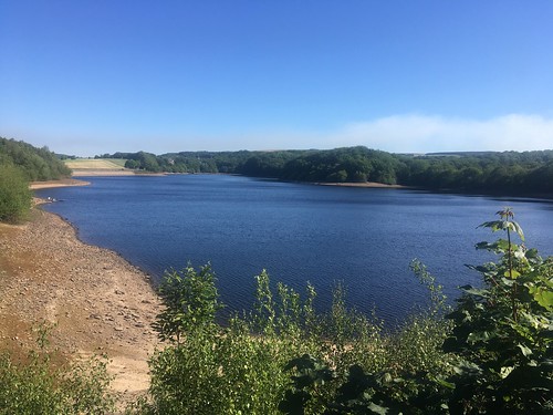
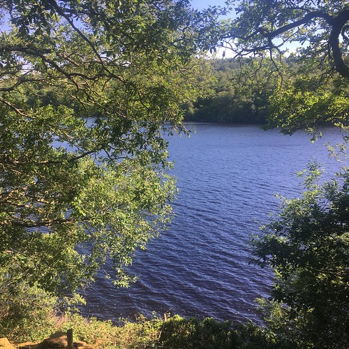
I decided I’d park up n the outskirts of Rivington and then walk round the Upper Rivington and Anglezarke reservoirs before heading up on to the moors. I set out early but when I arrived at my intended destination the car parks were all pretty full even at 9 o’clock in the morning. I parked up on the dam separating the two Rivington reservoirs and set up along the path on the west shore. It was very busy with cyclists, runners and dog walkers, none of whom seemed to think it was necessary to move over to keep 2 metres apart. I was glad when I reached Anglezarke reservoir. It was considerably quieter walking along the shore.

Looking over towards Black Coppice and Great Hill

At the top end of the reservoir by Healey Nab I walked along the minor road across the top end of the reservoir and then took the path along the eastern shore.

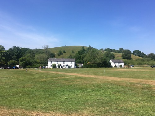
About a third of the way along the lake I took the path up the hill towards the moors. Past the old farmhouse

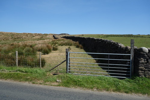
A short walk along Moor Road and then I climbed over the stile onto the moor.

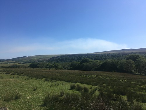
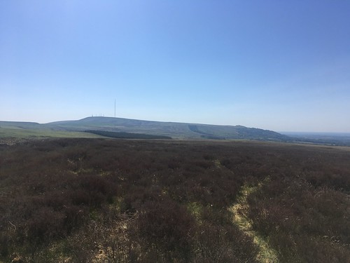
As I climbed higher I could see cloud in the sky over in the east beyond Great Hill. That wasn’t forecast.

As I got closer I realised that it was, in fact, a cloud of smoke. The barbecue brigade had been out and set fire to the peat over on Darwen Moor.

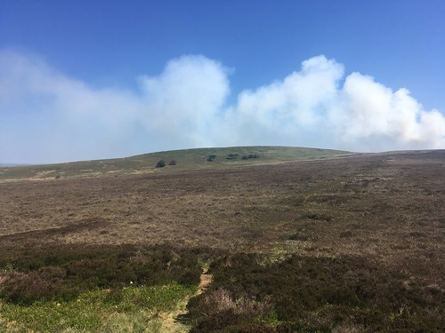
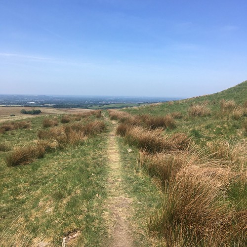
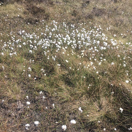
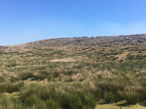
The moorland up here is a classic “Blanket Bog” of peat covered by sphagnum moss, heather, bilberry and cottongrass. With the recent long sunny dry spell the peat has dried out and it doesn’t take much to set it alight leading to the sort of highly damaging fires we witnessed a couple of years ago up on Winter Hill.

The fire did, indeed, appear to have been started by a disposable barbecue. It’s incredible to think that people are stupid enough to think that it’s appropriate to use these things up on the dry moorland. Luckily the local fire brigades managed to get the fire under control so it didn’t spread too far. There’s been a fire the day before up on Winter Hill and Rivington Pike. again the Fire Service managed to put it out before it spread too far.

The view towards Winter Hill and Rivington Pike

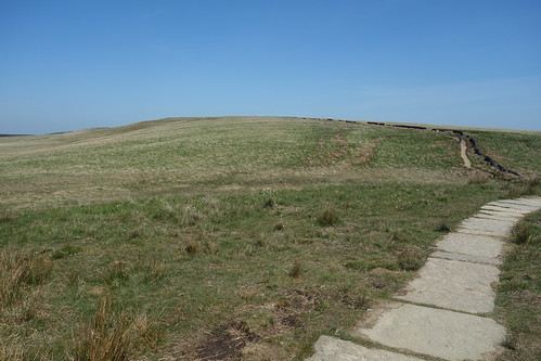
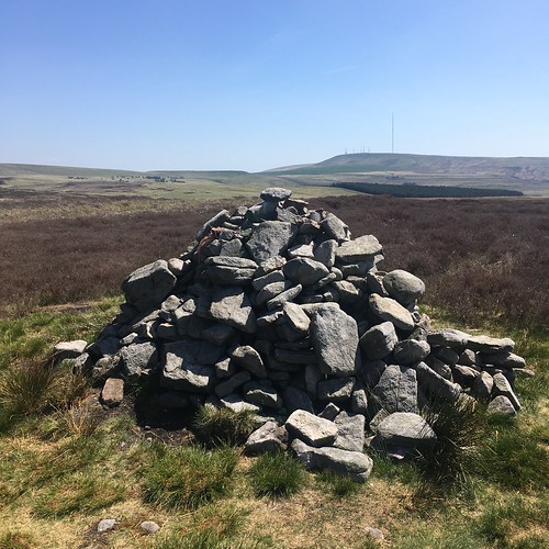
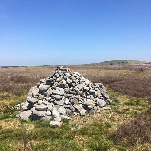
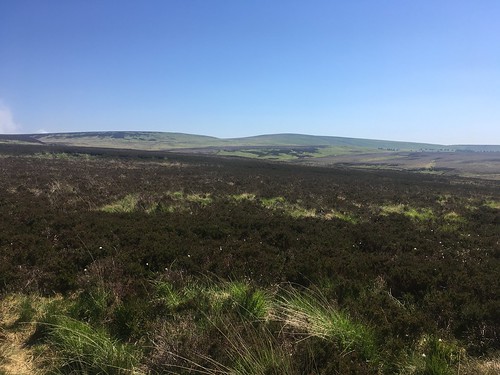
Anyway, carrying on along the moor I walked over Hurst Hill and on to Round Loaf, believed to be a Neolithic or Bronze Age bowl barrow or burial mound – the first of three prehistoric sites I’d visit during my walk.

On top of Round Loaf

From Round Loaf I headed south over the Moor, crossing over Devil’s Ditch which is thought to be the remains of a Neolithic boundary

Looking back over the moor to Round Loaf

and across to Redmond and Spitlers’ Edges

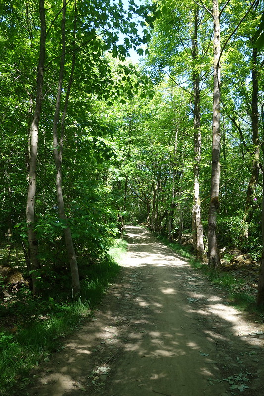
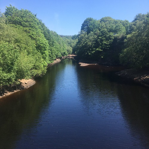
reaching Lead Mine’s Clough, rather than walk down besides the brook I took the past heading east back up onto the moorland

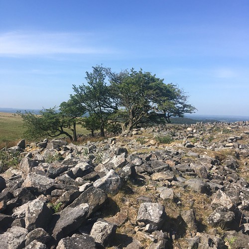
and made my way towards Pike Stones, the third Prehistoric site up on Anglezarke

The site comprises a collection of stones that used to be a Neolithic burial mound. There are several large slabs of millstone grit which at one time would have stood upright to form a burial chamber. Its a scheduled Ancient Monument

The stones themselves don’t look much, but it doesn’t take too much imagination to picture what they looked like when they were upright. Originally they would have been covered over with earth to form a mound and the stones themselves wouldn’t have been visible. However, the mound must have been a fairly impressive sight when it was standing, especially given the prominent location on a high ridge overlooking the South Lancashire Plain.

From Pikestones I set off towards Jepson’s gate

then cut back east along the track

then took the path south across the fields

towards Yarrow Reservoir

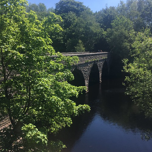
Reaching the road, I crossed over Allance Bridge

and took the path through the fields on the east side of the reservoir

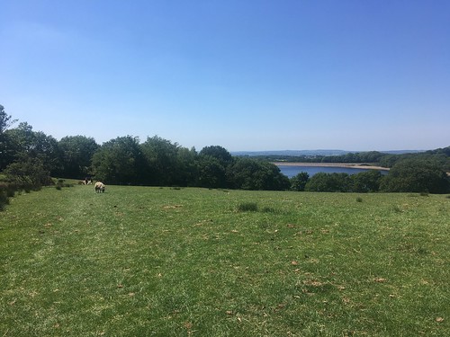
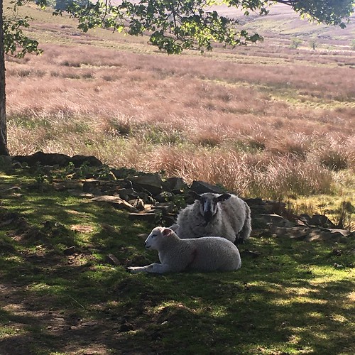
passing a few locals

It had quiet for most of my walk – I’d seen few people – but reaching the track at the end of Yarrow Reservoir it became very busy. There were groups of people, many who didn’t seem to be concerned about maintaining “social distancing”. I was glad to finally get back into my car.

Overall it had been an enjoyable walk, but I’d learned a lesson. keep away from Rivington on a fine day

Great Hill and Anglezarke Moor

This period of good weather continues and trying to make the most of it I decided to take a day off work and head up back on to the moors. I drove over to White Coppice arriving around 10 o’clock. It was already busy, but there was no problem keeping my distance from other people out exercising and enjoying the sunshine.

I set off along the path that would take me up to Great Hill

Looking back towards Chorley and Healey Nab from the top of the slope.

and looking ahead to the summit of Great Hill. A familiar sight. I’ve walked up here too many times to count, but never get tired of it.

Millstone grit!

Reaching the ruined farm at Drinkwaters, a couple of walkers had beat me to the bench. I carried on walking,

passing a couple of “locals”.

Looking across to Winter Hill and Rivington Pike across Anglezarke Moor.

the view to the north east from the summit with Pendle Hill just about visible in the distance

I turned south to follow the path along Redmond and Spitler’s Edges

DSC08036

and, just before reaching Belmont Road I turned south.

As I carried on along the path I heard a familiar bubbling cry and then 2 curlews appeared circling above me in the sky and across the moor. I tried to get a shot of them. This was my best effort – zoom in on the black blob in the sky. (if you can’t see it so well, perhaps a trip to Barnard castle is in order!!!)

DSC08045

I carried on across the moor towards the ruined farms of Lower and Higher Hempshaws

DSC08050

From there I decided to try a path I’d never walked down before, towards Sims, another ruined farm. Normally I’d follow a dirt track used by farmers but this route was more direct across the moor.

DSC08048

It wasn’t a very distinct path, not well trod. That wasn’t surprising really as it waas across peat and if we hadn’t had such a long dry spell this would have been very wet underfoot and a quagmire in winter. Even so, the going wasn’t so easy in places.

DSC08055

Reaching Sims I cut across the moor to Lead Mine Clough and then back up onto the peat to walk across to Round Loaf, which I’d visited only a week before.

There were two couples having a break on top. Keeping my distance I stopped for a bite to eat, taking in the view. This is a panorama of the ridge from Great Hill I’d traversed.

Leaving Round Loaf I carried on towards Hurst Hill, walking through a sea of bog cotton in bloom on the peat.

On the summit of Hurst Hill looking over the moors to Winter Hill

and over to Great Hill

After a short break I was off again, this time down a path that, despite many years spent up here, I’d never walked down before. It took me across the moorland in the direction of Anglezarke reservoir. The wooded hill in the mid ground is Healey Nab.

The path was faint in places as I made my way through the heather. I took a short diversion to take in the top of Grain Pole Hill – another first.

I carried on towards the minor road where there were a couple of cars parked up in a layby.

Leaving the moor

DSC08084

I walked down the hill and then took the path to the left of the Goit (a watercourse linking the Roddlesworth and Anglezarke reservoirs

DSC08088
DSC08089

back towards White Coppice.

Another great day up on the moors. It had been relatively busy, but I’d passed fewer people than I’d encountered when I’d been shopping at the Marks and Spencers food store a couple of days before – and it had been a lot easier to keep my distance from them.

Anglezarke and Great Hill Circular

2013-06-07 15.43.30

After a pretty miserable start to the year the last week has seen us experiencing some good, warm, weather, with blue skies and sunshine. Having been stuck indoors for most of the week I decided to take Friday afternoon off and get out in the fresh air for a walk. I didn’t want to stray too far so drove the eight miles or so over to Anglezarke, to go for a walk on the moors that have been my stomping ground ever since I was a young teenager.

I parked up at the viewpoint overlooking Anglezarke reservoir and walked the short distance up the road to Jepson’s Gate where I was able to gain access to the moor.  Despite being surrounded by some significant towns the West Pennine moors wild and remote.

I did a favourite circular route of about 6 miles which toko me 3 hours including 3 short stops. It’s a mix of wild moorland and a walk through woodlands along the reservoir at Anglezarke. While I was up on the moor I only passed 2 people coming the opposite way but saw three curlews, a number of skylarks and plenty of sheep.

2013-06-07 15.06.10

There were more people around when I descended back into the valley to walk along the reservoir.

From Jepson’s gate

I cut across the open access path over to Pikestones, the ruins of a Neolithic long barrow.

2013-06-07 14.11.19

It can be heavy going across the peat, especially as there isn’t a properly defined path, but as there’s been very little rain of late it was quite dry underfoot.

2013-06-07 15.04.20

I then cut across the moor heading towards Round Loaf, a Neolithic round barrow  which is a dominant feature on the relatively flat moorland landscape(there are a number of prehistoric remains on the moors here).

2013-06-07 14.34.03

I climbed to the top of the mound and rested for a while. Visibility today was limited – on a good day it’s possible to see the mountains of the Lake District and Snowdonia, but it was hazy in the distance. But there were good views of Winter Hill and Rivington Pike to the south east

2013-06-07 14.45.23

and towards the summit of Great Hill to the north

2013-06-07 15.04.33

my next destination. I cut across the moor trying to follow an indistinct path. Fortunately it was dry underfoot as the peat can be quagmire. There were a few ditches and rivulets that had to be traversed.

I climbed up towards the summit and took another short break while taking in the views.

2013-06-07 15.13.07

Then I walked along the ridge and took the path that would lead down to White Coppice. I passed the ruined Drinkwaters farm (it must have been a difficult life living up here) whose only residents were sheep sheltering in the shade.

2013-06-07 15.31.48

Eventually I descended down to White Coppice, a small hamlet with a manicured cricket pitch and attractive cottages at the foot of the moors

2013-06-07 16.00.21

I took the path along the Goyt, a channel that takes water from the reservoir at Roddlesworth across to the one at Anglezarke. The landscape changed to pleasant woodland providing some welcome relief from the direct sun

2013-06-07 16.19.03

Reaching Waterman’s cottage

2013-06-07 16.20.28

a short walk along the road and I was on the path that took me along the east side of Anglezarke reservoir

2013-06-07 16.28.08

with a short diversion past the smaller Bullough reservoir

2013-06-07 16.44.31

and then through the woodland on the shore of it’s larger companion

2013-06-07 16.48.20

2013-06-07 16.51.51

Then it was a short climb up the hill back to the viewpoint to rejoin the car.

The route. (Image produced from the Ordnance Survey Get-a-map service. Image reproduced with kind permission of Ordnance Survey and Ordnance Survey of Northern Ireland.)

Anglezarke, Great Hill and White Coppice

The weather has been too good this week to stay in the office, so I decided to take a few hours off Tuesday afternoon and get up on the moors to clear my head. When I was a teenager I used to spend hours up on the West Lancashire Moors and knew them like the back of my hand. Although they’re surrounded by industrial towns they’re wild and isolated and a good place to find some solitude. I didn’t go up there for a long time, but over the last few years have started to rediscover them. This walk is one of my favourites taking in different types of terrain, wild moors, farmland and a lakeside path, a picturesque hamlet and  one of the most dramatic locations for a cricket pitch in England.

I parked up at the viewpoint above the reservoir. I walked along the road as far as Jepson’s gate and climbed over the stile on to the open access land and headed over the rough ground towards “Pike Stones”. The ground was dry – quite different to the last time I visited the Neolithic monument in the early Spring when it was sodden underfoot.

Jepson's Gate

Pike Stones

Pikestones is a collection of stones that used to be a Neolithic burial mound. There are several large slabs of millstone grit which at one time would have stood upright to form a burial chamber. It’s a scheduled Ancient Monument. There’s an information board about the site with an artist’s impression of what the burial mound may have looked like when it was built.

Leaving the site I took the path at the back of a plantation of fir trees and then cut across the moor towards “Round Loaf”,  a Neolithic or Bronze age Tumulus, or burial mound, which dominates the flat moorland. It’s situated on open access land and the peaty ground going can be really difficult after wet weather – but this time  it was dry underfoot. Nevertheless, it was still hard going at first as the ground is rough and there was no distinct path until I got nearer to the tumulus. There were extensive areas of blackened grass on the moors and even part of the western side of the mound itself was scorched. Standing on top, I could see that the grass over to the east was still on fire but, fortunately it was smouldering rather than properly ablaze.

"Round Loaf"

Standing on top of the mound I had a good view of Great Hill ,Winter Hill and the surrounding moors, but the atmosphere was very hazy. It wasn’t even possible to make out the coast at Southport. The tumulus is in such a dominant position high on the moor that on a good day most of the Lancashire coast is visible and it’s possible to see as far as the mountains in three National Parks – the Lake District, Yorkshire Dales and Snowdonia.

Looking towards Great Hill from the Round Loaf

After a short break I set off again across the moor towards Great Hill and then climbed to the summit. which is the highest point on this part of the moors. Again there were great views of the surrounding hills and moorland, but long range visibility was poor. Although it can get busy on nice weekends, mid-week, even on a nice day, it was fairly quiet. It can be windy on the exposed top, and a shelter has been built to protect walkers who reach the summit on blustery days. I stopped for a while to take in the view and some refreshments before setting off down the hill towards White Coppice.

On the way down I could hear the bubbling sound of a curlew and looking up could see it circling over the moor.

On the summit of Great Hill

White Coppice is a picturesque hamlet with a cricket pitch nestled at the foot of the hill. It has an industrial past though, owing it’s existence to lead mining and quarrying in the nearby hills.

White Coppice

From White Coppice I took the path over the fields and along the river to Waterman’s cottage at the bottom of Anglezarke reservoir – one of a string of reservoirs created to supply water to Liverpool.

Waterman's Cottage

Anglezarke reservoir

I made my way along the east side of the reservoir and then climbed the hill back to my car.

Image produced from the Ordnance Survey Get-a-map service. Image reproduced with kind permission of Ordnance Survey and Ordnance Survey of Northern Ireland.

I’ve saved a map of the route here.

Pikestones

Spring is in the air at last and as it was a reasonable day and I didn’t have much else I desperately needed to do I decided to go out for a walk. A short drive, park up the car and put on my boots and then I was heading towards Anglezarke Moor, a favourite haunt of mine since I was in my teens.

Last year when we went on holiday to Pembrokeshire we saw quite a few prehistoric dolmens – standing stones – which are the remains of prehistoric burial mounds.  Anglezarke also has a number of prehistoric sites so I decided to base my walk on them.

Pikestones is a collection of stones that used to be a Neolithic burial mound. There are several large slabs of millstone grit which at one time would have stood upright to form a burial chamber. Its a scheduled Ancient Monument

The stones themselves don’t look much, but it doesn’t take too much imagination to picture what they looked like when they were upright. Of course, originally they would have been covered over with earth to form a mound and the stones themselves wouldn’t have been visible. However, the mound must have been a fairly impressive sight when it was standing, especially given the prominent location on a high ridge. Standing by them today there was a reasonably clear view over the west Lancashire plain right down to the sea, which was just about visible.

Sadly some idiot has defaced one of the main stones, carving in some sort of symbol – this, in turn, has now been defaced.

A short distance away, over the moor, there is another prehistoric relic – “Round Loaf”, which is a Neolithic or Bronze age Tumulus, or burial mound.  It’s constructed on top of a flattish area of the moor so that it stands out and is visible from quite a distance away, silhouetted against the horizon, particularly when viewed during a walk up to Great Hill from White Coppice, when it stands out against the sky. Its the largest example of a round barrow in the north west of England and, because of its remote location, its never been excavated.

Looking towards "Round Loaf" which is silhouetted against the Great Hill

I didn’t trek over to the tumulus today. It involves yomping over the peaty moor and conditions underfoot weren’t that great. It’s worth it on a good day, though, as if you are lucky there are magnificent views. One particularly clear day, standing on top of the tumulus, as well as views of the West Lancashire Moors and the Liverpool Bay I was able to see the mountains of three national parks – the Lake District, the Yorkshire Dales and Snowdonia.

"Round Barrow" - photo taken during a previous visit to Anglezarke Moor