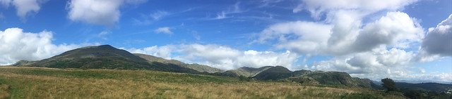
Last Friday I managed to get out again for a walk. This time I decided to go up to Coniston with the intention of climbing Dow Crag and then on to the Old Man of Coniston. I ended up walking a little further than that!

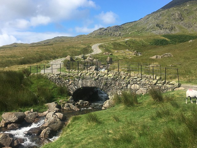
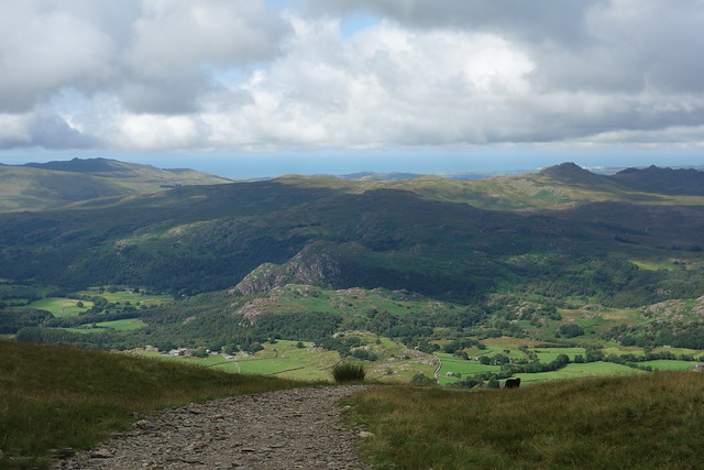
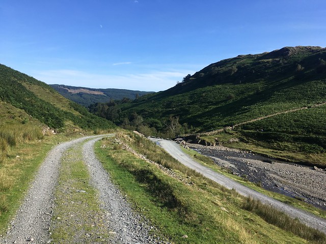
I parked up in the village and then cut across the fields to join the Walna Crag road just after the old quarry car park.

I crossed the old pack horse bridge after which the path started to steepen
My first objective over to the right!
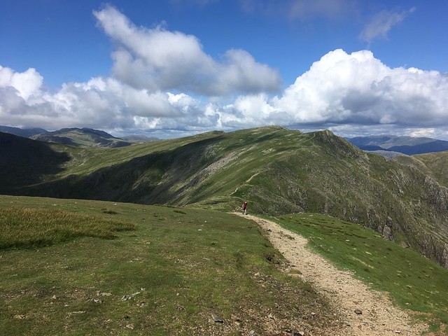
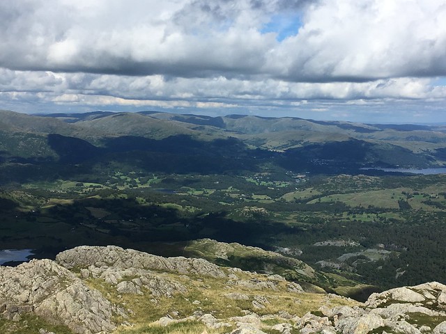
Dow Crag is at the end of a ridge with two other peaks – Brown Pike and Buck Pike. As I started up towards the first of these there were great views over to nearby fells and valleys – last time I was up here just over 12 months ago I couldn’t see a thing as the fells were covered in low cloud.
I carried on, reaching the top of the pass turning right to start climbing up towards the ridge. Looking west to the Duddon estuary
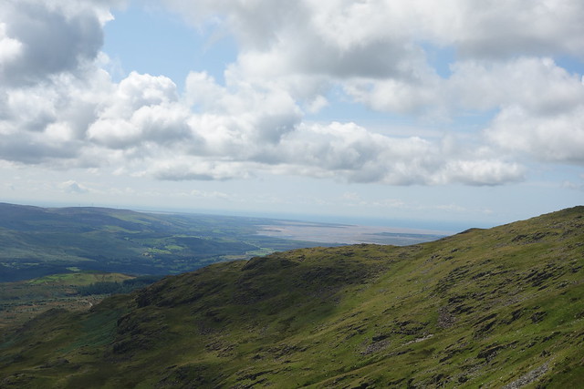
The Duddon Valley
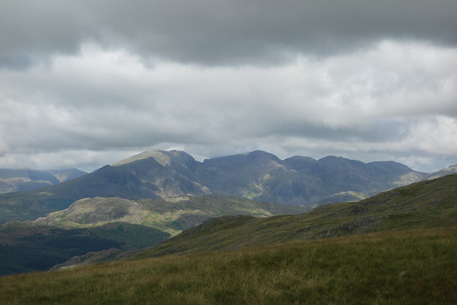
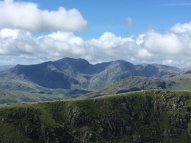
The Scafells over to the northeast. They would soon be shrouded in cloud.
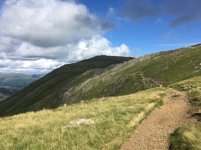
I carried on along the path towards Buck Pike. Although the east side of the ridge consists of steep, rocky crags that plummet down to the bottom of the valley, the west side is a much gentler slope, so the walking wasn’t difficult .
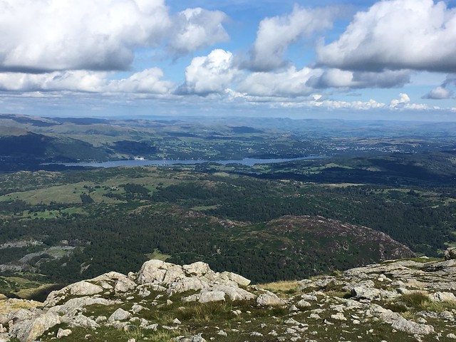
Looking across to the Old Man

and down to Coniston Water

As I climbed up to Buck Pike, looking down I had a view of Blind Tarn. It got its name as it has no apparent inflow or outflow

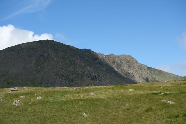
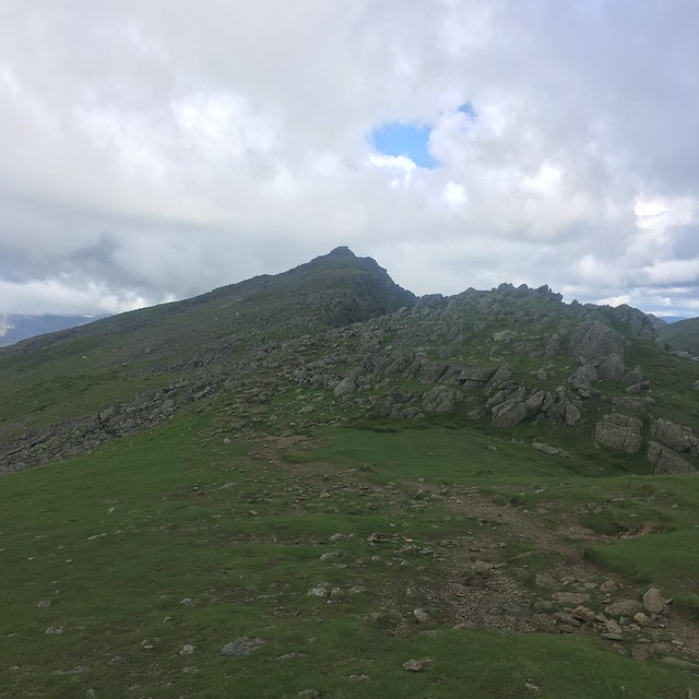
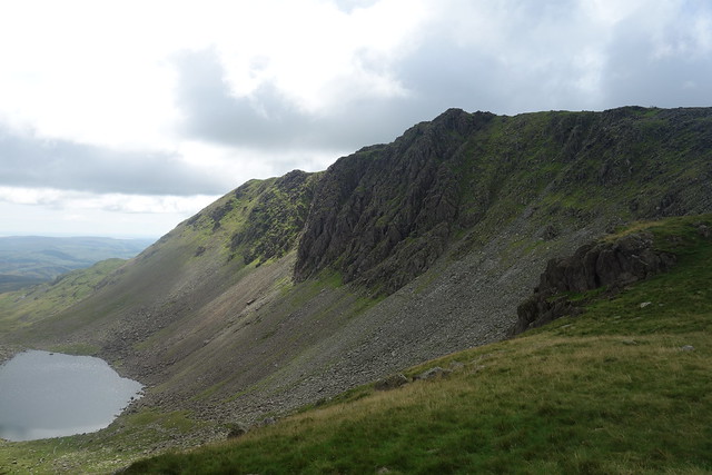
Dow Crag ahead.
Unlike during my last walk up here, I could see the rocky crags, a favourite haunt of rock climbers. But none were evident.
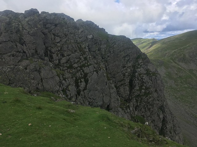
Looking down one of the gullies
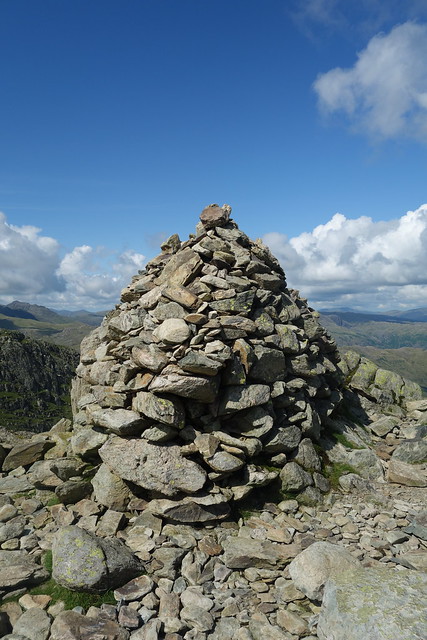
The summit of Dow Crag is crowned with a pyramid of rocks. Despite my dislike of heights I clambered up carefully, gritting my teeth and being careful not to get too close to the edge – I’m no crag rat!

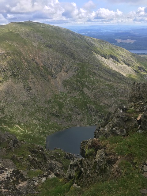
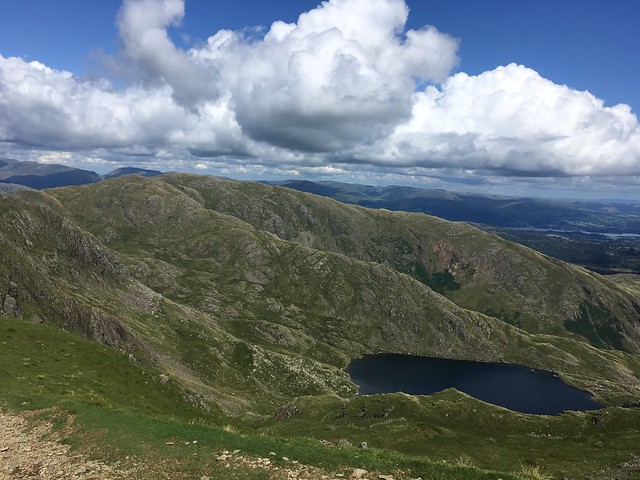
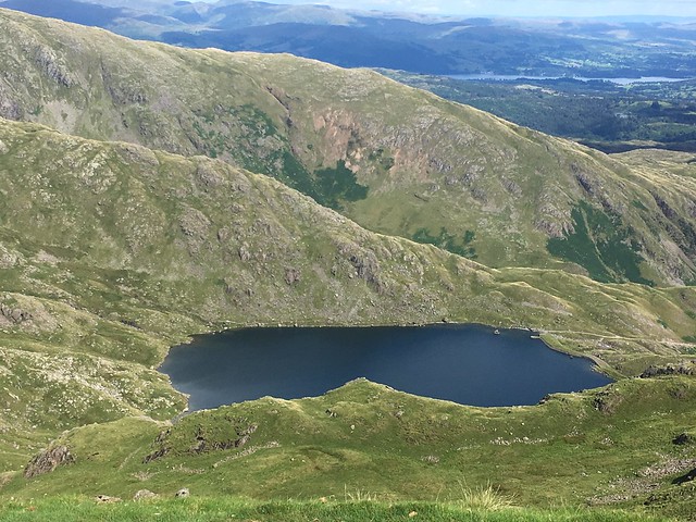
Looking down I could see Goat’s Water, the large tarn in the valley below
I’d seen a few people as I’d made my way up from Coniston following the same route as me. Some had passed me and raced ahead while with others, walking at a similar pace and occasionally stopping to take in the view (an excuse for a rest?) we kept overtaking each other. As I reached Dow Crag a large party were coming up from the other direction.

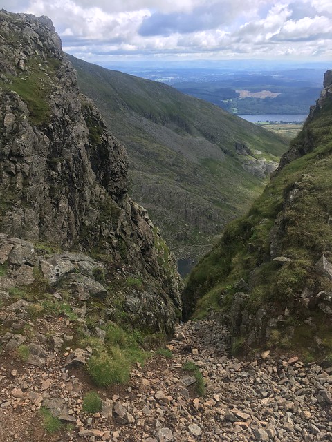
After a brief break for a bite to eat I carried on. The path initially descends to Goats Hawse before climbing up to The Old Man. Last time I’d descended down into the valley and then back to Coniston but this time I carried on climbing. There were plenty of people coming down the other way, most taking the path down to Goat’s Water.
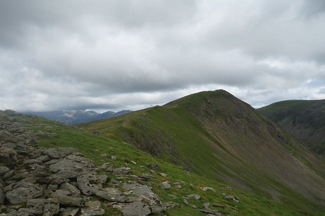
Looking back to Dow Crag from the hawse
and down to Goat’s Water

Climbing the path up the Old Man from the Hawse – I could see a lot of people ahead.

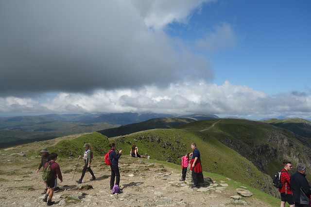
It was very busy on the summit. The route up to the Old Man from Coniston is very popular. It wasn’t as crowded as when I’d climbed Snowdon a few weeks ago – there isn’t a train! – but there were plenty of people who’d made it to the top.

I stopped for a while to take in the view and snap a few photos. The weather was improving as the cloud that had been threatening was clearing.
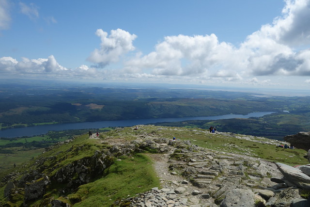
Looking down to Coniston and Coniston Water

Copper Mine Valley

Down to Low Water

The cloud hadn’t cleared from the Scafells

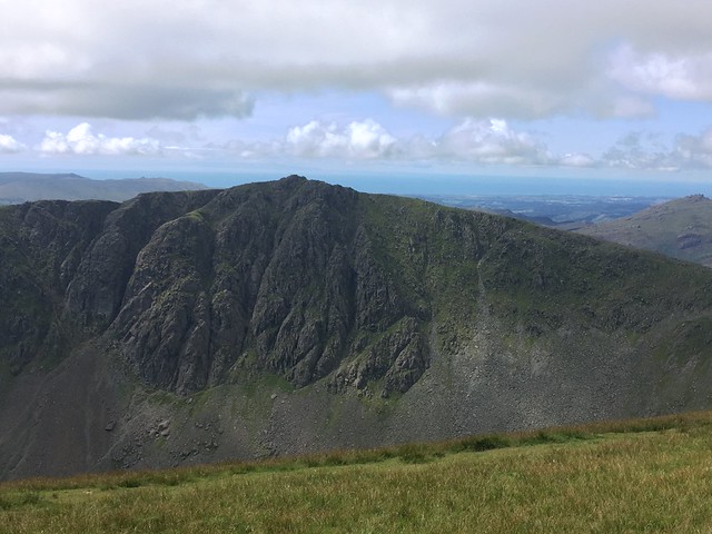
Dow Crag
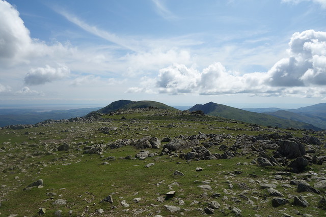
Looking along Brim Fell and the path to Swirl How
My original plan had been to descend down the “tourist path” to Coniston and have a brew in a cafe, but with the weather being so good and the fells looking so inviting, I decided to carry on along the ridge over Brim Fell to Swirl How and then descend down via Lever’s Water.
I didn’t have to walk too far from the summit to get away from the crowds. Very few people were straying this way or coming from the opposite direction.
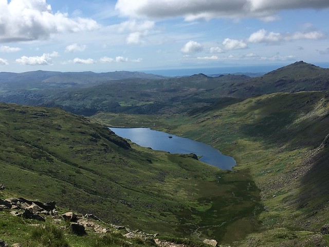
Looking down to Lever’s water
and, on the other side of the ridge, down to Seathwaite Tarn.
It had taken less than an hour to reach the summit.
Time to take in the views!
The cloud had cleared from the Scafells by now.
Looking over Lingmoor and Little Langdale (where I’d walked the previous week) towards the Helvelyn range and the Fairfield Horseshoe.

Looking back along the ridge to Brim Fell and the Old Man
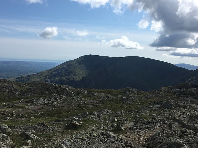
and then there was Weatherlam, the last fell on the ridge.

I didn’t quite have the summit to myself, but almost. I chatted to another, younger, walker who had been following the same route as myself and there were a couple of other walkers taking various routes. But it was very peaceful compared to the Old Man.
With the weather so good – it’s rare to get such a good day in the Lakes – it looked very inviting, so another change of plan. I had to descend down the “Prison Band” which is a slightly tricky route, to Swirl Hawse and had then intended to follow the path down to Lever’s Water and then down Coppermine Valley back to Coniston. Instead, I decided to carry on and tackle Wetherlam to complete the round.
Loooking towards Little Langdale , Pike o’ Blisco and the Langdale Pikes from the hawse


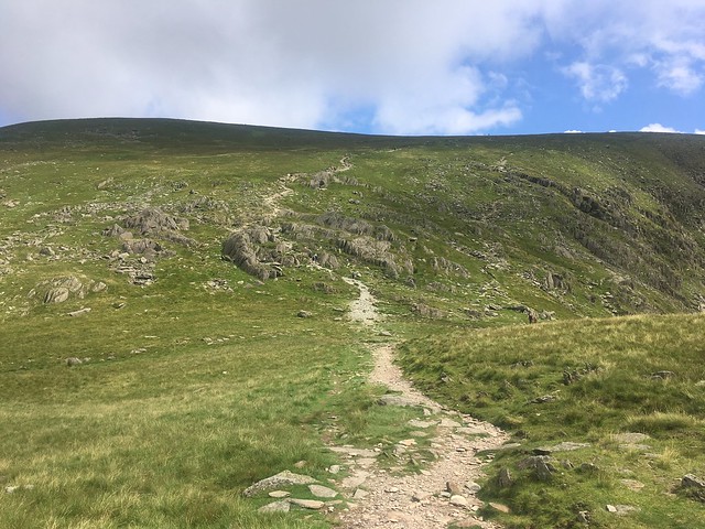
Onwards and upwards to Wetherlam
I passed a mother with her two young sons coming up the Prison Band as I was descending and an older couple with their dog coming from Wetherlam and when I reached the summit I met the young man who I’d been talking to on Swirl How. But that was it.
Here a a few photos of the views from the summit of Wetherlam. They just got better as the day went on!


Looking across to the Old Man
I took the path heading southwards along the ridge of the fell which descends fairly gradually towards the Yewdale fells, turning down Hole Rake to Coppermine Valley and then back to Coniston. It’s a fair walk, about two and a half miles to the village
There were outstanding views to Coniston Water

The path down Coppermine Valley
Looking back up the valley towards the fells.

By the time I made it back to the village, all the cafes had closed for the day. The pubs were open, of course, but were very busy with lots of people sitting outside enjoying the sunshine.
It had been probably the longest walk I’d done for a long. I gone a lot further than I’d originally intended, but when the going is good, the good keep going! And I’d thoroughly enjoyed it.
And I hadn’t quite finished. When I’m in Coniston I have to go and have a look at the lake. Especially on such a sunny evening.


Sounds like a great day. When I did the Round, about twenty years ago, I deliberately did it in the oposite direction, and included Great Carrs and Grey Friar as diversions from Swirl How, which I wouldn’t have included it they’d had to be added at the end of the walk.
You don’t get many days like this one. It was perfect for walking
Crikey, how far was that? You are incorrigible. Some of those pictures looking down made my stomach clench, particularly the one’s of Goat’s Water.
Well, counting wander down tothe Lake my pedometer gave 18 miles. A few fewer “map mile” but the pedometer takes account of the gradient. But it was such a great day. Got to keep at it while I can!
I’m not great at heights so the photos probably look a little more scary than they were in reality
18 miles! Very impressive. I remember doing 15 earlier in the year and that was coastal so mostly flat. I was kn*ckered – way out of my comfort zone these days.
That was definitely the edge of mycomfort zone. My knees knew about itthe next day after a long descent!
I bet!
It amazes me that you ( and people) can identify all the many different pikes, peaks and all the other land marks. I’d recognise the shape of Pendle Hill from any photograph – and I’d know the Old Man and Helvellyn looking up from ground level, but I wouldn’t have a clue about any others just from sight. I’m very impressed! 😁
It’s just a case of familiarity. I go up to the Lakes and so can recognise quite a few of the fells. The same for you with Pendle Hill and th’Owd Mon!
Wow. Your walk is in complete contrast to my walk through central Paris yesterday! As an aside, I know that Wigan is further west, but my parents were northeners: my mother was a Sheffield lass and Dad came from Northumberland County. Question: aren’t you a little bit nervous walking alone in such isolated (but beautiful) territory? What would happen if you injured yourself?
Yes, Sheffield isn’t so far away – although the wrong side of the Pennines 😂
As for walking solo, I enjoy it as it gives me time to reflect and think, but, yes, there are dangers. There are usually other people around, especially inthe Lake District, but sometimes It’s quiet. So precautions are needed – have a phone and spare battery with me ( although reception is not completely reliable up there) and make sure someone knows whereI’ve gone. Never needed Mountain rescue yet, touch wood!
Amazing walk, you were so lucky with the weather. I haven’t been out in the fell since beginning of the month as the weather is horrible in the north west of the lake.
Yes the weather has been terrible lately.
During July and August work tends to be quiet and I’m able to take days off at short notice, so I have been keeping an eye on the weather forecasts looking for days when it’s likely to be OK. The advantage of working for yourself 😀
That’s a classic walk and with the weather getting better you were rewarded for carrying on. We did some of that walk last year, but after descending Prison Band we didn’t climb Wetherlam. I have that one as an awkward solo fell to do.
Yes, I ended walking further than originally planned, but it’s easy to be flexibke when up on the ridge.
Wetherlam is a favourite peak, but I’ve yet to tackle the more challenging route up by Wetherlam Edge from Tilberthwaite
That’s a cracking walk, and what a good day you had for it. It always amazes me how walkers arrive on top of the Old Man by the coachload but never stray from it. With such a collection of impressive peaks in easy reach along the ridge too!
Too true! The Old Man is oneof those “honeypot “ peaks. But sometimes climbing it does inspire people to try climbing other fells.
Yes, it’s a lot of people’s first fell. I took advantage of the long summer evenings a couple months ago and did it after work. First time, I’ve ever had the summit to myself (well apart from a couple of Herdwicks).
Classic route, classic day. One of the finest high level walks in the UK in my opinion. The ridge from the Old Man to Swirl How is just superb, high level with very little height loss/gain. Just what mountain walking should be.
Summed up in a nutshell 👍
It looks like the weather was on your side (just!). Such stunning scenery though. Thanks for sharing your walk/hike with us 🙂
The weather got better and better throughout the day. Mind you the cloud was coming in by the evening and during the night and the next day we had the wind and downpour. I was back home well before that, though