Mud, mud glorious mud. Nothing quite like it……
We’ve had a lot of rain lately with the occasional fine day. Last Monday, determined to make the most of one of the latter but wanting to avoid the muck and slutch which has been an inevitable consequence of the former I decided to head to limestone country where the underlying geology makes it more likely that I’d be able to avoid too much sticky stuff. Unfortunately I had a Zoom meeting scheduled first thing that couldn’t be rearranged, meaning an early start wasn’t possible so I decided on Scout Scar, the limestone ridge to the west of Kendal, starting from Sizergh castle, only an hour’s drive away once the rush hour traffic had died down.
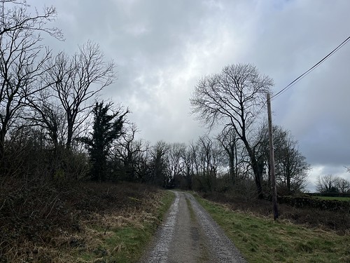
There had clearly been a heavy downpour just before I arrived at the National Trust car park and the sky was more threatening than expected, but that wasn’t going to put me off. So I booted up and set off across the fields

before taking the path up hill.
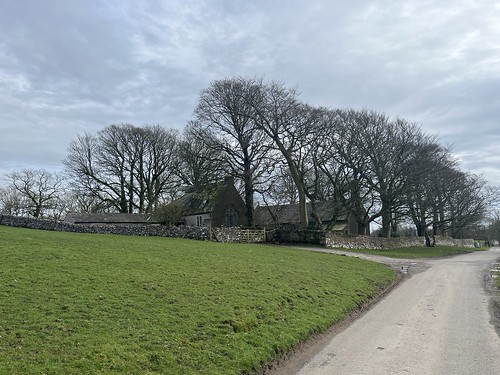
After a short steep drag the path levelled out towards the small church of St John Heslingdon


From the viewpoint near the church there were views over to the Kent estuary and Whitbarrow

but although there’s an excellent panorama of the Lakeland Fells from here on a good day, the cloud base was low to the west and they were well hidden in the murk.
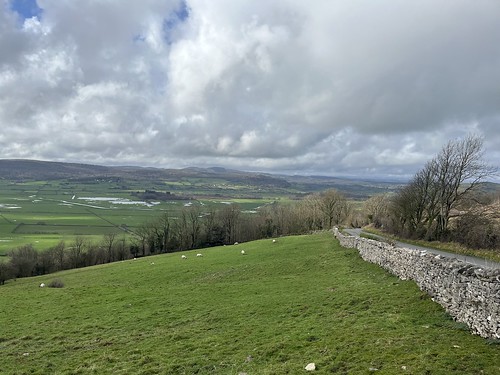
I carried on along the narrow road, crossed over the Brigsteer Road and started to make my way up the fell.
It’s a gradual climb up the fell
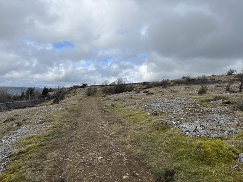
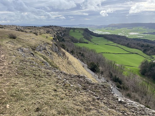
Reaching the top of the limestone plateau I was battered by a strong, cold breeze.
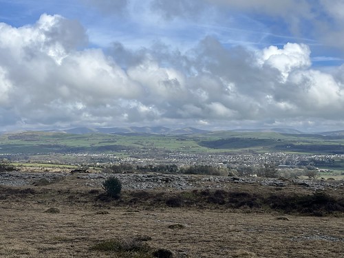
There were good views opened up over to the cloud free Howgills and the Westmorland Borrowdale to the north east, over the town of Kendal

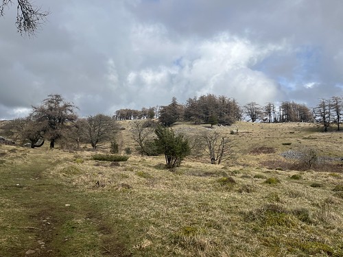
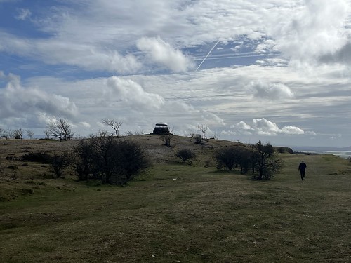
It’s something of a lunar landscape up her – well something like it as the surface of the moon isn’t covered with stunted trees.

I reached the “Mushroom” and stopped for a while sheltering from the wind while I refuelled. I wished I had a flask of hot Vimto to warm me up.

Zooming in on the Howgills
The Lakeland fells were still “clagged in”, though.
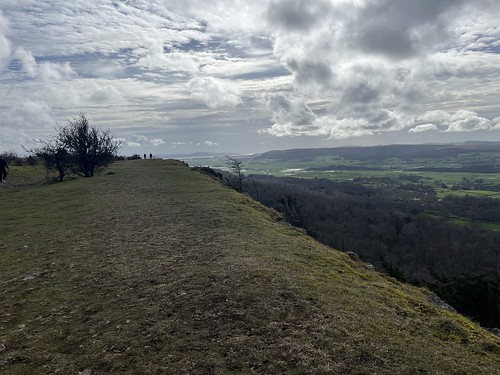
I carried on to the end of the fell

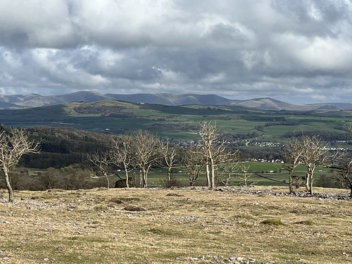
and took in the view over towards Kentmere and the eastern Fells
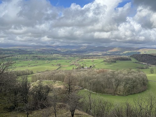

Then turned around and followed the edge of the Scar


I gradually made my way back to the little church
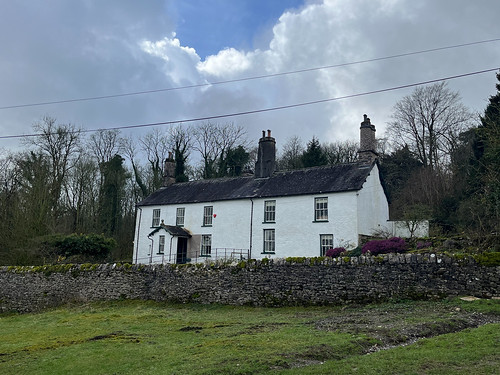
and then down the hill and through the fields returning to Sizergh Hall

where I stopped off at the cafe for a brew and a cake before debooting and setting off on the journey home.
It’s a nice half day walk this. And I’d managed to avoid too much mud! The weather had been coming in during the afternoon and it rained again that night.


A wise choice after all the rain.
If you had dropped into Brigsteer Woods you may have seen the truly wild daffodils.
That gives me an idea for our visit up in May, we have NT membership so might pair the castle with this walk
One of our regulars. Nice bit of scenery/
Indeed. I’ve seen your posts. I agree about the scenery.
A great walk. I haven’t been to Sizergh Hall yet.
Another place worth a visit if you’re nearby.
It’s lovely countryside around there.
It is. And less busy than the main part of the Lakes.
That’s quite an unusual spot!
How do you mean unusual, Ruth? Tge Scar is different from most of the Lake District but the landscape probably isn’t untypical of some other limestone areas
Unusual to look at,apart from the occasional scrub trees it looks like another planet.
Yes. I’d agree with you there!
Never done it. It’s going on my list for this year.
A nice easy walk with stunning views on a good day. I like the “unworldly” landscape too
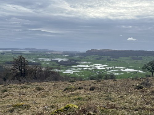
Those flooded fields tell the story of how much rain we’ve had
They do Jim. Some of the flooding is actually “rewilding” to recreate a marshland environment, but I’d say a good two thirds of the water is on flooded agricultural land which would have beenn reclaimed years ago.
I love the limestone edges in that part of the Lakes. They get overlooked by the mass tourists so they are unspoilt and quiet. I’m up in Silverdale with Mark and his family over Easter so maybe I’ll get a chance for a walk around there
I think I first went up Scout Scar after reading a blog post by either you or Mark. Can’t recall which of you though. It’s become a favourite short walk